RV-8 and the Lunch That Almost Wasn't
Saturday June 27, 2026 was almost a stereotypical late June day in the PNW. It was cloudy, rainy, and a bit unpredictable. It was also right on the heels of about a week of unusually warm weather. In fact, with the forecast all week making it look pretty wet, I hadn't even planned to fly. I was going to spend the day making room for the soon to be delivered, hopefully, Rans S-21 kit.

After the morning coffee and bull session, we went to take a look at the weather. Whilst checking, we noticed that there was some activity around the former Eviation hangars. There was a flatbed truck with a set of wings on it. I noticed last week that they had a T-34 fuselage outside and I opined that they might be restoring it. As it turns out, they have two that they are restoring. One was obtained from Argentina, or someplace like that, and the other one, the one that I saw last week, was recovered from the bone yard and was indeed a Navy trainer. They are both T-34Cs and will be restored to flying condition.
It is quite the eclectic collection they have there, there are three T-34Cs, one flyable, and two L-4s, both flyable and both up on airplane lifts in the back.
After talking with those guys for a while, we noticed that the weather around Arlington looked pretty good, though there were still a lot of clouds and rain to the southwest, but it was moving to the northeast and would be clearing later in the afternoon, so we decided to try for Chehalis. If it didn't work out, we thought of a couple of plan B's.
The airport wasn't too busy, so we didn't have any real trouble getting out and on our way. I managed to get ready to go a couple of minutes before Carl, so I took off on 34 and went the long way.
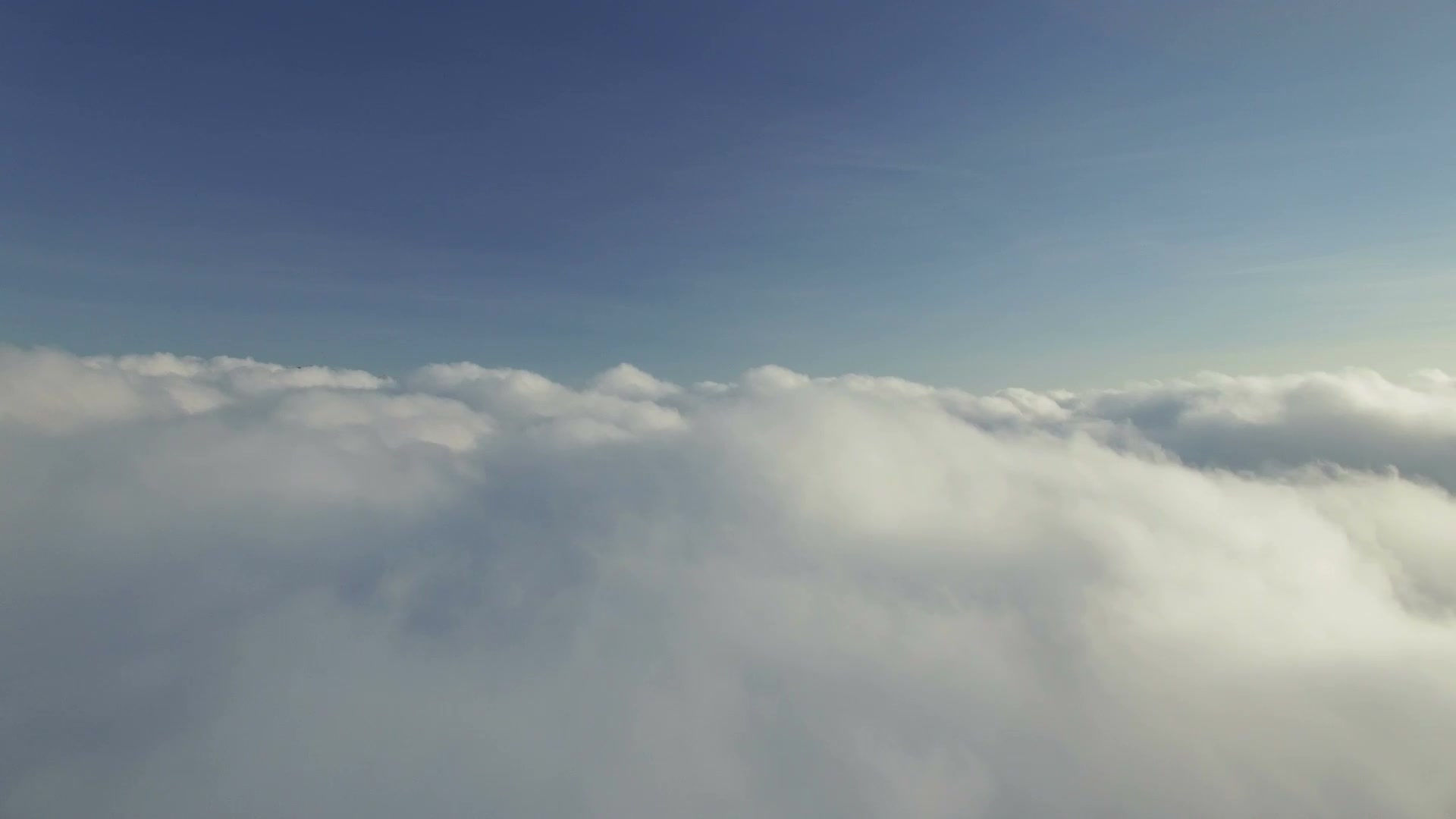
As mentioned earlier, there were still a lot of clouds in that direction and I really didn't want to stay below them because I thought it would be bumpy down there. As I headed west, I could see lots of holes in the clouds, so I decided to try to get on top. I noticed as I climbed that the bases were at about 3,300 feet. The layer closer to us didn't go too high and 6,500' or so would have been enough to clear, but further to the southwest, towards Bremerton and beyond, they went higher. I ended up going all the way to 10,500' to get clear of the clouds and still had to go around some higher cloud peaks.

I noticed, as I traveled on, the rather extreme lack of holes in the clouds. There were some small holes I could see through, and the cloud layer didn't look all that thick, but they weren't big enough to descend through if needed. Since it was clear where we departed from, particularly over the water, I was hoping to find the same thing further south.
There are sometimes two different types of partly cloudy days around here. Some days there are clouds over the water but the land is clear and other days there are clouds over the land and the water is clear. Of course, there are also days where the clouds defy any form of organization. I was hoping this was one of the clear over the water days, since there is a lot of water to the north of Olympia. If that were the case, it would be relatively easy to descend before passing Olympia and make the rest of the trip below the clouds.
As I made my way past Bremerton, it began to look like we were in luck. A very large hole opened up, right where I hoped it would be. I began descending through it, knowing that I was too high and would have to do some maneuvering and a few 360s to get below the clouds. The lower I got though, the worse it looked in the direction we needed to go. There were rain showers all around Olympia, but mostly to the west and southwest, as can be seen in the first photo above.

The image above is rotated 180 degrees from the photo above, so the darker sections on the left were actually what is seen on the right of the photo at the top of the page.
It looked like maybe we could go down the east side of Olympia and then work our way toward Chehalis, but I was worried about one, the poor visibility where it was raining, and two, the possibility of some turbulence in the vicinity of the heavier showers, so we decided to exercise the better part of valor and head for a plan B.
The two alternates we discussed before takeoff were Bremerton and Pt. Townsend. I asked about Bremerton and Carl suggested we just bag it and head home. Since I had lunch waiting for me in the hangar, I was OK with that. Passing Bremerton though, he suggested we head to Pt. Townsend. Apparently hunger had gotten the better of him and he was ready for a stop.
Since I had descended so far to see below the clouds, I decided to make the trek home under the clouds rather than climbing all the way back on top. I hoped it wouldn't be too bumpy and it wasn't. There were some showers visible off to the left but we looked to be well clear of them. That is, until it started raining on me. It was mostly light, but there was one brief section that was heavier and still, I couldn't see anything in front of me that looked like a shower.
It would be pushing 3:00 by the time we got there and it turns out the Spruce Goose Cafe closes at 4:00. Fortunately, that was no problem. In fact, it may have helped as it was really easy to get a table. By the time we finished, it was too close to 4:00 to go over to the museum, they also close at 4:00.
As I approached Jefferson County International Airport (Jeffco) from the south, there was a woman in a 172 shooting touch-and-goes. Not wanting to crowd her or make her nervous, I gave her a wide berth, so I ended up flying a wider pattern than usual. In all of the planning to be out of her way, I wasn't paying attention to my own approach and ended up way high on final. I ended up having to pull the power all the way off to get down and then started dropping like a rock, so I had to bring in more power to arrest the descent rate. I probably should have gone around and tried again, but I managed to pull off an acceptable, but not quite good landing. I wasn't really trying for it, but it ended up being a three pointer. I haven't done one of those in a while.
There was a pretty nice looking Murphy Super Rebel out front of the old FBO hangar and I wanted to go have a look.

It looks like the aircraft was completed in 2022, so that would explain why it is in such good condition. As we approached, I noticed something odd about the main landing gear. There is an extra brace behind the main gear leg that I don't think I have seen on a Murphy before.

After looking at the Murphy, we saw the door to the maintenance hangar for the museum open, so we decided to go have a look. As soon as we walked in we saw what is pictured below.

It looked very familiar, but also different. My first guess was a Waco UPF-7, but the turtle deck doesn't look right. That's because it is a Waco UPF-7 that has been modified for a closed canopy on the rear cockpit and the turtle deck was modified to accommodate it.

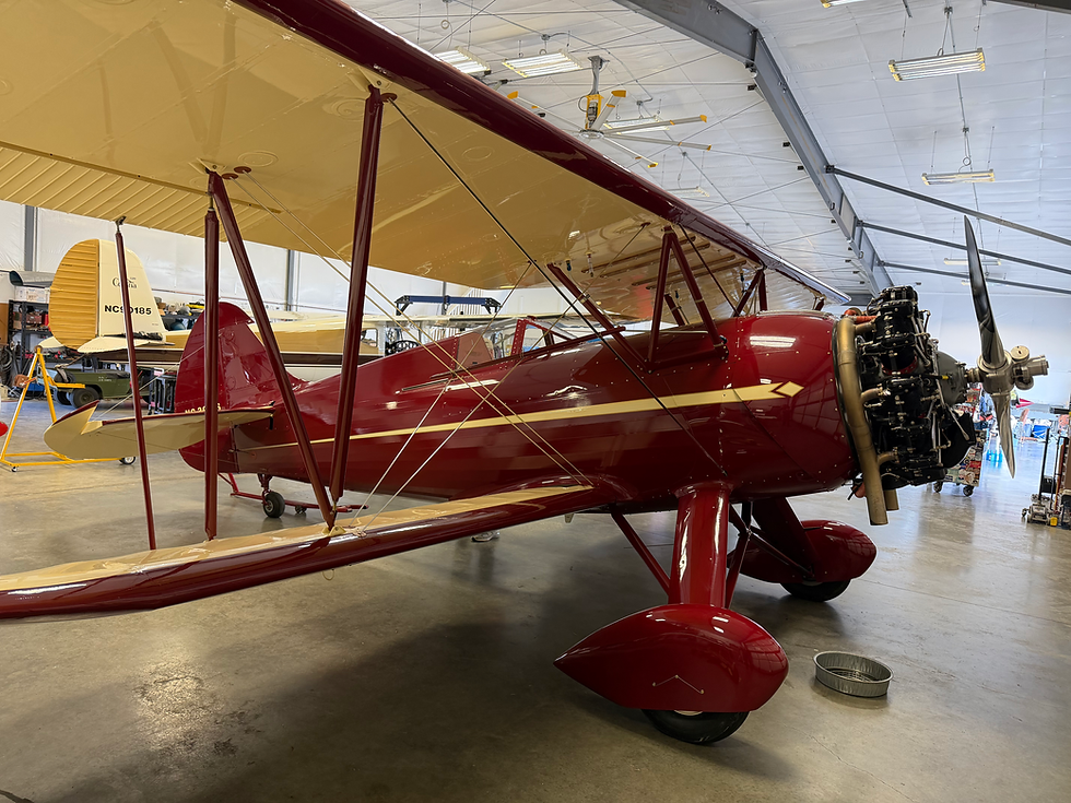
We offered to trade two RV-8s for the Waco and for some reason, the guy didn't seem interested. Sure, it could have something to do with the fact that he didn't own it, but why should that slow things down.
The trip home was much shorter than the trip there. The direct route between Arlington and Pt. Townsend is about 27 miles. Getting there via Olympia, is considerably longer.
When we got back it was fairly quiet at Arlington. There were a few airplanes around, but nothing problematic. For a day that I hadn't planned to fly, it was a very pleasant flight.
A video of the flight can be seen here.


Comments